
1992: Kedron Wavell RSL installs 45 poker machines.
1992: The Australian Tax Office was built on the corner of Gympie Road and Banfield Street.
1994: Brisbane 2011 The Liveable City of the Future Plan was released.
1996: Chermside Regional Business Centre amended to allow the Centre to expand north of Banfield Street into Commonwealth land occupied by Telstra at the time.
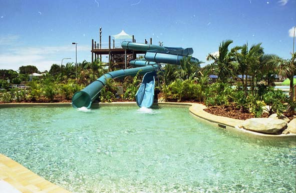
1996: Chermside Aquatic Centre replaces the Olympic Pool (built 1964).
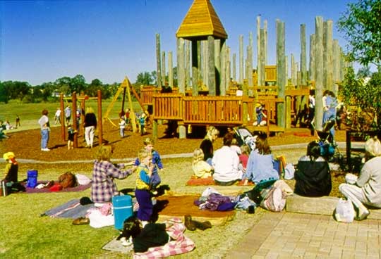
1996: Kidspace opened in 7th Brigade Park.
1996: Westfield bought Chermside Shopping Centre.
1997: New Brisbane City Council library was built on the corner of Kittyhawk Drive and Hamilton Road and was the first Regional Library in Brisbane.
2000: Northside Regional Business Centre opened.
2000: Kedron Wavell hockey fields opened (one synthetic and two grass fields).
2000: Chermside Veterinary Hospital expanded (Green Cross).
2001: Holy Spirit Hospital Northside opened beside The Prince Charles Hospital (now called St. Vincent’s Hospital).
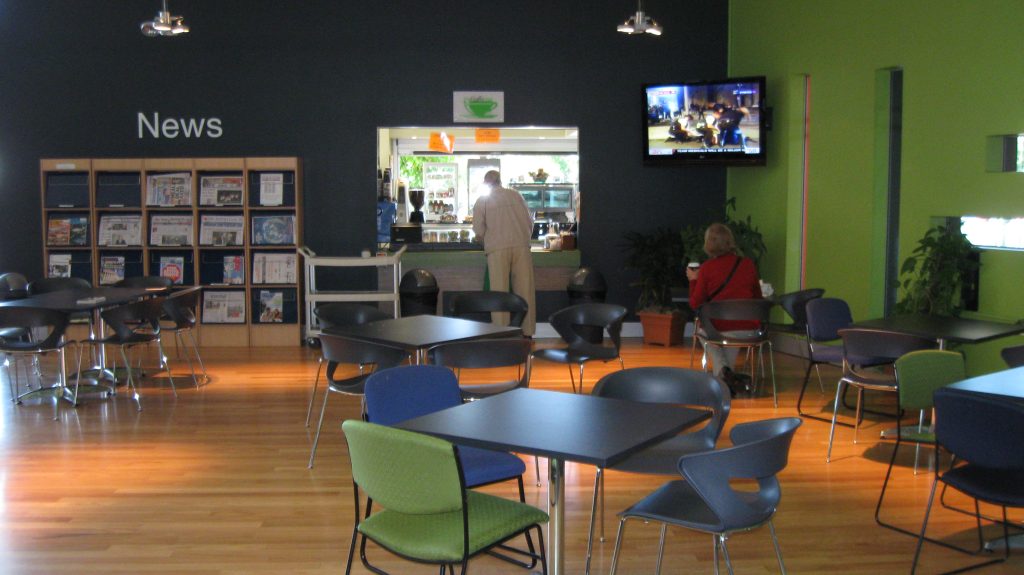
2004: Expansion of the Chermside Library with a $2m upgrade, includes meeting rooms, café, and more book shelving room.
2004: Aldi Supermarket opened on Gympie Road.
2005: Southeast Queensland Regional Plan released with Chermside designated as a growth hub.
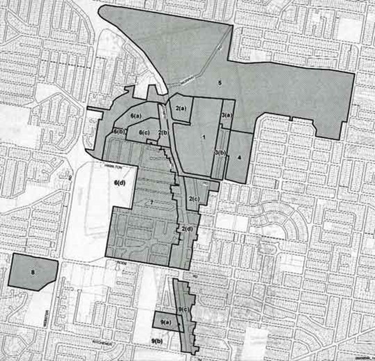
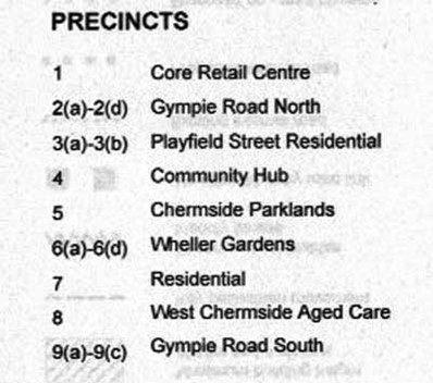
2005: Chermside Major Centre Local Plan was released to allow high-rise residential and business premises in a much larger area than in 1987 and 1996.
2005: Chermside set to dominate the north Brisbane landscape as the area’s growth hub through the South-East Qld Regional Plan. Chermside is recognised as a Primary Activity Centre in the plan.
2005: First high-rise residential in Chermside. Chermside Central has nine levels in Playfield Street.
2011: Another six high-rises on Playfield Street with five more nearby and another one in 2012.
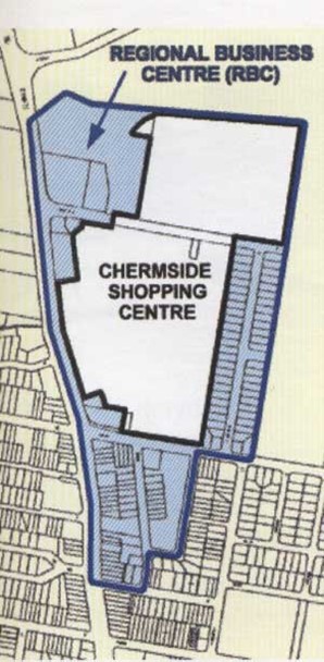
In 1987 the Brisbane City Council rezoned the area marked in blue around the Chermside Shopping Centre as the Chermside Regional Business Centre. The white area north of Banfield Street may have been left for Shopping Centre expansion. In 1996 another rezoning took place to allow the Shopping Centre to expand northward over Banfield Street to Downfall Creek. This had been the site of a Telstra training area since the 1940s. The aim of the Brisbane City Council in rezoning this area was to attract high-rise business offices from the Brisbane Central Business District. The area was bounded by Gympie Road on the west, the Downfall Creek on the north, Kittyhawk Drive on the east, and Hall, Thomas and Charlotte Streets on the south. The inner part was for the already-existing Shopping Centre and, later in 1996, allowing it a northward extension over Banfield Street to Downfall Creek.
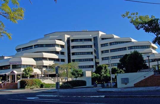
The only enterprises to build in the area were the Australian Taxation Office, rising nine levels making it the tallest building in Chermside at that time and the Commonwealth Building, both in Banfield Street.
With the failure of the plan to attract businesses to Chermside the same area was again rezoned to allow high-rise residential and some commercial development. Further changes took place in Chermside due to the State Government drawing up the South-East Regional Plan in the early 21st century. In 2005, Chermside was designated a growth hub and became a Major Centre with a Local Plan drawn up to allow high-rise residential and business premises in a much larger area than the earlier Regional Business Plan of 1987 and 1996. It also included extra zones not covered in the earlier plans. The new plan extended it west over Gympie Road and south to Kitchener Road in Kedron.
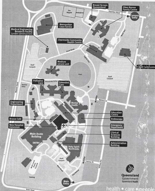
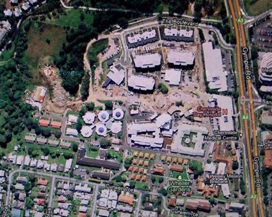
The Prince Charles Hospital occupies an area of 90 acres or 36 hectares set on a ridge overlooking much of Chermside. It started in the early 1950s as the Brisbane Chest Hospital to treat tuberculosis and has gradually grown into a very large General Hospital with a world reputation in Cardiac care. It was joined by Holy Spirit Hospital in 1999 (now named St. Vincent’s Hospital) and together they are a health service for the surrounding area.
Wheller Gardens began in 1936 in the small cluster of red roofs in the foreground, the first aged care settlement in Brisbane. It expanded into one of the largest in the buildings across the lower part of the photo. Wheller on the Park began in 2007 as a retirement village under the curve of The Boulevard. It is continuously expanding. The upper of the two long white buildings fronting Gympie Road is the old Chermside Regional Business Centre now home to the NDIS. While the lower is the Chermside Medical Centre.
Over nearly 70 years, Chermside Shopping Centre has changed quite a lot.
In 1957, Allan & Stark Drive-In Shopping Centre comprised:
1 department store – Allan & Stark
1 supermarket – Brisbane Cash and Carry
25 specialty retail stores
A total of 27 shopping outlets
Floor space: 6,000 square metres
700 car parks
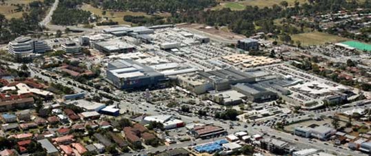
In 2012, Westfield Chermside Shopping Centre comprised:
3 department stores
4 discount department stores
4 supermarkets & liquor stores
16 cinemas
1 bowling alley
39 stand-alone ATMs
432 specialty retail outlets
A total of 484 shopping outlets
Floor space: 123,740 square metres
2012-2015: There was a focus on developing Chermside’s infrastructure to support its growing population. This included improvements to public transport and road networks. The Prince Charles Hospital in Chermside also underwent significant expansion during this time.
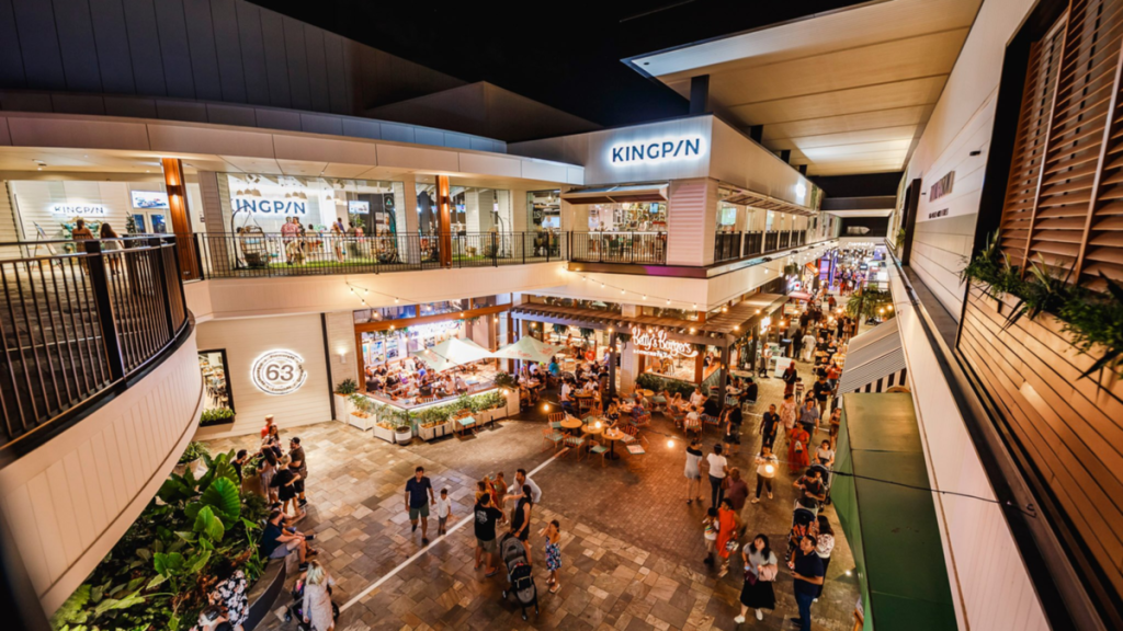
2016: Westfield Chermside announced another major expansion, adding a new dining and entertainment precinct. This expansion aimed to position Chermside as one of Brisbane’s leading entertainment destinations.
2017: The expansion of Westfield Chermside was completed. The centre became home to more than 500 stores, making it one of the largest single-level shopping centres in Australia.
2018-2021: Chermside continued to grow and develop as a residential and commercial hub. The population increased, and the suburb became even more ethnically diverse. High-density living continued to be a feature of the suburb, with more apartment complexes being built.
Today, Chermside is a vibrant, bustling suburb known for its shopping, dining, and entertainment options.
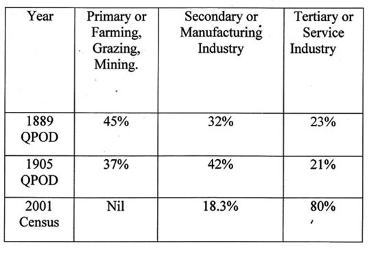
These statistics show the great changes that have taken place in Downfall Creek - Chermside industries over the last 120+ years. The Downfall Creek district was originally a farming area with a manufacturing sector mainly geared to the local farms and the local hamlet of Downfall Creek. It has since developed into the suburban area of Chermside in which industry is dominated by the provision of services with a small but important manufacturing sector.
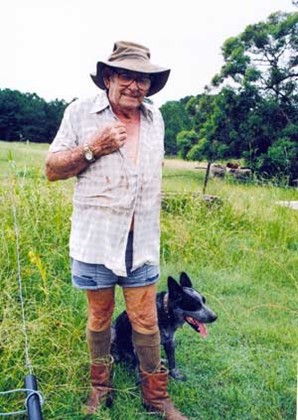
While we are looking at the change in the type of industry in Chermside it is salutary to stop and find the exception that proves the rule. When the census of 2001 shows that Primary Industry is at last extinct in Chermside, down near the place where Downfall Creek goes under Gympie Road, the last grazier in Chermside, assisted by his blue heeler, was quietly tending his herd of cattle. Admittedly he had come to the end of the road as his lease was up. Norm had created his own little niche mowing the abundant grass in the time-honoured fashion of grazing. The land he used is now under a Tertiary Service Industry, the retirement village of Wheller on the Park. Now the statistician may be able to accurately write 0% for Primary industry in Chermside.
This text was written by Patrick O'Shea in 2010. It was updated by Patrick O'Shea in 2012, by Sherry Mackay, Julia van Zon, and Bradley Scott in 2023, and by Bradley Scott in 2025.


All content © 2010-2026 Chermside & Districts Historical Society